UCSF Space Ceiling Raised by over 40%

On January 21, 2021, the UC Regents approved a significant revision of the earlier 2014 Plan for  UCSF’s Parnassus Campus- despite objections from San Francisco’s Board of Supervisors who asked for a delay so the Plan could be studied further.

According to a UCSF report, “On Jan. 21, the Regents certified the Environmental Impact Report for Comprehensive Parnassus Heights Plan (CPHP), which amends UCSF’s 2014 Long Range Development Plan to adjust the space ceiling limit, projected campus population, and the Mount Sutro Open Space Reserve boundary.”

(You can find the new Plan here (as a PDF):
UCSF-Comprehensive-Parnassus-Heights-Plan)

For us in the Forest Knolls neighborhood, the main impacts of the change will be from the higher Space Ceiling, and the accelerated destruction of Sutro Forest.

THE SPACE CEILING

The Space Ceiling was established in 1976 in response to neighbors’ anger at the impact of UCSF’s unrestrained growth on surrounding neighborhoods. There is more about that here. It has been expanded from 3.55 million square feet – which had been exceeded several times, with existing square footage in as of 2014 in the range of 3.84 million square feet. This Plan will raise the ceiling to 5.05 million square feet.

In the forest, tree felling started in 2019, and the pace appears to be accelerating.

An article in SF Weekly in October 2019 discussed this new Plan, noting that neighbors had concerns and those were not really taken into account.

Anyway, the Plan is going ahead despite any objections, since UCSF is in practice only answerable to the Regents.

Sutro Forest 2017 Plan Imposes a Landslide Risk

This article is reprinted from SaveSutro.com with permission. The landslide hazard described touches our neighborhood; Christopher Drive and Crestmont are both in Forest Knolls!

This is risk that may actually increase over the years as a result of actions being taken now, for two reasons.

  • First, tree roots take time to die and rot, but when they do, they weaken the living geotextile that stabilizes the hillside.
  • Second, trees take up water and help to regulate moisture deep in the ground. When large trees are cut down and stop doing this, small saplings and ground cover are not an effective substitute. So if the trees are cut in dry or normal years, nothing may happen for a while – and then a really wet year can trigger landslides that would not have happened if the trees had remained.

Landslide under blue tarp. South Ridge at top left.

We’re reading the Draft Environmental Impact Report (DEIR) for the 2017 Sutro Forest Plan, and got to the section on landslide risk. This has been one of our concerns, especially since the tragedy at Oso, Washington, where the felling of trees in previous years was a factor in destabilizing the slope. (We wrote about that HERE: Cut Trees, Add Landslide Risk) We know this area is subject to landslides – we had a blue tarp covering unstable areas in Forest Knolls for a year when cutting trees destabilized a slope, and another just above UCSF’s Aldea housing area.

SHOCKING LANDSLIDE INFORMATION

We were shocked at what we found in the DEIR:
“Increased instability could cause a landslide that would impact Crestmont Drive, Christopher Drive, and Johnstone Drive. An existing landslide scarp is visible above Christopher Drive. Some homes along Christopher Drive could be placed at additional risk from localized landslides due to plan implementation. Phase I activities would result in a potentially significant impact…”

The map above is taken from the DEIR. All the dark green areas are potentially unstable. All the gold areas are potentially unstable. All the cream areas are potentially unstable. The little red blobs and stars are already unstable. The black arrows show the direction of potential landslides – right into our communities. Here’s the key to the map. The light yellow and light green areas are where they are cutting down trees in Phase I (five years, starting this fall – 2017):

Legend to Landslide Hazard Map Sutro Forest 2017

What’s the proposed “mitigation”? Avoiding work in the forest for 2 days when the soil is wet after rain. This completely ignores the fact that landslides are a MULTI-YEAR hazard after tree removal.

Here’s the proposed mitigation in their own words:
“After a significant storm event (defined as 0.5 inches of rain within a 48-hour or greater period), the following conditions shall be met prior to any vegetation management activities:

  • The maps detailing areas of historic slope instability or rock fall in the Final Geotechnical and Geological Evaluation Report for UCSF Mount Sutro shall be reviewed (Rutherford + Chekene 2013) 
  • If ground-disturbing or vegetation removal activities are proposed within or adjacent to areas of historic slope instability or rock fall, the saturation of the soils shall be estimated in the field; if muddy water drips from a handful of soil, the soil is considered saturated (Brouwer, Goffeau and Heibloem 1985) 
  • The areas of historic slope instability or rock fall shall be flagged if the moisture content of the soils is determined to be high (i.e., muddy) and ground-disturbing or vegetation removal activities shall be avoided for a minimum of 48-hours after a significant storm event to permit soil drying…”

In other words, we won’t chop down trees in the rain or when the soil is wet.

Other mitigations are palliative. They’re planning to build roads into the forest for trucks and heavy equipment, and those roads will follow the contour of the slope. The quarter-acre staging plazas – where they’ll remove trees so trucks can turn around and heavy equipment be parked – will be flattish, with a slight slope for drainage. None of this is as effective as not building these roads or bringing in heavy equipment in the first place.

WHY THE MITIGATION IS MEANINGLESS

The problem is, the effect of cutting down trees is a LONG TERM problem. The effect of tree removal takes years – not days, not months – to fix. In Oso, Washington, the slope gave way three years after the last tree-destruction. Here’s the story (from the article we published at the time). The tragedy was foreseen… but the regulators thought they had enough mitigations in place.

On March 22, 2014, a huge landslide destroyed the small Washington community of Oso. Rain was of course a factor, as was erosion at the base of the slope. But it’s probable that tree-cutting above the slide area was an important factor too. An article in the Seattle Times that quotes a report from Lee Benda, a University of Washington geologist. It said tree removal could increase soil water “on the order of 20 to 35 percent” — and that the impact could last 16-27 years, until new trees matured. Benda looked at past slides on the hill and found they occurred within five to 10 years of harvests [i.e. felling trees for timber].

There had been red flags before. The area was second growth forest, grown back from logging in the 1920s/30s. Over 300 acres were again logged in the late 1980s.

The first time regulators tried to stop logging on the hill was in 1988. But the owner of the timber successfully argued that measures could be taken to mitigate the risk. Eventually, the state only blocked it from logging some 48 acres, and the owners  gave in on that.

In 2004, new owners applied to cut 15 acres; when the Department of Natural Resources (DNR) objected, they halved the area and re-located the cut. DNR gave approval, subject to no work during heavy rain and for a day afterward. The tree-cutting finished in August 2005.

In January 2006, there was a major landslide 600 feet from the cut zone. The state built a log wall to shore up the slope.

The owners continued logging. In 2009, they removed 20% of the trees. In 2011, they removed another 15%. In 2014, the hillside collapsed.

The regulators were aware of the risk; they thought they were mitigating it with their restrictions and reaching a compromise with the owners. But it wasn’t enough. Destabilizing the mountainside is a long-term thing; the effects can show up in months, but it’s more likely to take years.

THE LESSON FOR MOUNT SUTRO

Our mountains not only are potentially unstable, they actually have landslides. The picture at the end of this article shows one on Twin Peaks, where rocks tumble after nearly every heavy rainy season.

The roots of the trees are helping to hold the unstable soil in place and that as the roots rot, landslide risk will increase.  It is going to be more unstable 2-3 years after the trees are removed than 2 days after it rains.  The information that instability increases over time is a little counter-intuitive.

Moreover, removing the trees takes away their ability to suck water out of the soil. If the tree-cutting is done in dry years, it may take a wet winter to trigger landslides… which would not have happened if the trees had been regulating the water and functioning as a living geotextile.

Since UCSF are not going to use herbicides on the stumps to prevent them from resprouting, they say they will grind the stumps.  That is an effective way to prevent resprouting, but it will greatly increase the instability of the soil because the heavy equipment digs down several feet into the stump to destroy the roots.  That’s another reason why they should not destroy trees where slide risk has been identified.

Anyone seriously considering the map above can only hope that UCSF will draw a better conclusion than the Washington State loggers and regulators. The planned destruction of thousands of trees – many within the first five years – could cause landslides in surrounding communities not days or months later, but years after the event.

UCSF: First, do no harm!

West of Twin Peaks Central Council Meeting – Jan 2014

west of twin peaks council meeting January 2014The West of Twin Peaks Central Council (WTPCC)  had its first meeting of 2014 on January 27th, back in its lovely old club-house in Forest Hills. (The WTPCC is an association of associations; it has some 22 member organizations, including Forest Knolls Neighborhood Organization.) Attendance was thinner than usual, perhaps because of the cold. But they got a quorum of 11 delegates and things went quickly.

NORMAN YEE, D7 SUPERVISOR

Our District 7 Supervisor Norman Yee was present, and he spoke about pedestrian safety, and about using some funds he has available for the West Portal playground, and also to expand some open space beside Ingleside library. He’s setting up a system where various projects will be posted, and the ones people want the most will get funded. (Here’s a link to that process.)

RECREATION AND OPEN SPACE ELEMENT (ROSE)

Sally Stephens spoke about the Recreation and Open Space Element of the General Plan. It sets guidelines for how the city will use its open space in years to come. She was part of a working group convened by the Parks and Recreation Open Space Advisory Committee (PROSAC) that made exhaustive inputs into the draft plan. However, when the draft came out, they found they still had significant concerns, and submitted comments. The comment period is now closed, but WTPCC will send a letter in support of the concerns of the working group.

MT DAVIDSON

Jacquie Proctor spoke on behalf of the Miraloma Park Improvement Club about concerns regarding tree-felling in the forest on Mount Davidson by the Natural Areas Program. The WTPCC decided to send a letter in support.

MT SUTRO

I was invited to give a quick update about Mount Sutro Forest. UCSF has made some significant changes to their original plan. First, the range of slightly confusing objectives in the earlier plan have been simplified to focus on Safety. This is good because it enables a rational conversation about what that means and how best to achieve it. Second, and this is important: UCSF has committed to continuing its ‘No Pesticides’ policy on Mount Sutro. It has used no pesticides there since 2008, but the earlier Plan would have used up to 3 times the amount of pesticide used by SF Recreation and Parks Department in its parks – repeatedly, for seven years. There’s also been some reduction of the acreage affected, and the number of trees potentially destroyed has been reduced to around 4-5,000.

Forest Knolls will be most impacted by the new plan, though, with most of the tree-felling in the portion of the forest above our neighborhood – the purple area in the map below. (I will write about this in more detail another time.)

UCSF Revised Plan Map

I also spoke about the Natural Areas Program, which will affect one-quarter of Sutro Forest, including the narrow strip of forest along Clarendon Avenue, and on the Cole Valley side of the forest – and a total of 32 parks in the city. The new management plan (known as the Significant Management Resource Areas Management Plan) includes:

  • Cutting down 18,400 trees,
  • Restricting access to people and pets, and
  • Using increased amounts of herbicides.

PETITION

The San Francisco Forest Alliance has a petition up, asking the Mayor to rein in this program.  (That’s HERE, in case you want to sign.)

Night Walk with Fog and Dog

It was late for a walk last night, and the fog had wrapped our neighborhood in its soft blanket. Yet the night called me, and out I went.

It was magical. The fog softened and dispersed the light of the streetlamps. As I walked up by the forest, I could hear the rain… except it was dry where I stopped on the sidewalk. In the forest, the trees made their own rain from the fog, and it pattered onto the leaves of the understory like a heavy shower. This is the Cloud Forest effect. Under the eaves of the forest, the cloud-rain was heavy enough to flow down the street and into the gutter. Inside the forest, the undergrowth and the duff absorbed it all. (If you walk in the forest — be prepared for mud on some of the interesting trails.)

It was late enough that I shouldn’t have expected anyone to be out there. But I’d have been wrong. In 30 minutes, I encountered 4 people, all walking dogs. As I said once in a post, the dogs of Forest Knolls make us all safer. Paws on the street mean eyes on the street.

Copyright and Sutro Stewards

As some of you already know, I received a letter from a major law firm on behalf of Sutro Stewards whose  Executive Director  is Craig Dawson. (It was actually for San Francisco Parks Trust and Sutro Stewards.) It said two things: First, that I had defamed Craig Dawson and the Sutro Stewards; second, that I had violated copyright on two maps.  Most the of the allegations pertained to another website, www.sutroforest.com, which is a website fighting for Sutro Forest.

(Anyone who is interested can find my discussion of their allegations here.)

However, the copyright issue touches this website via a map I published in my post on hiking in the forest.  I believe the map I used was based on one that was non-copyright. Nevertheless, I have taken down the map. For now, I’ve provided a link to a trail map; later I’ll add back a map for readers of the post to reference. [ETA: I’d also used it to explain what UCSF plans to do with the forest. That’s also been removed for now and will be replaced later.]

WHAT WAS THE ISSUE, ANYWAY?

The Letter said I had violated a Sutro Steward copyright.

This was confusing on several levels.

1.  The map I used was distributed at a meeting called by Rec & Park. Rec & Park circulated it as Exhibit B of a memo for an agenda item before the Parks Commission, cropped exactly as described above. It carried no copyright information or attribution. [ETA: This memo can be obtained from Rec & Park under the Sunshine law. Anyone can get a copy.]

Did Rec & Park steal the map without the Sutro Stewards’ knowledge? No. The minutes show that both Craig Dawson and Ben Pease were at the hearing and were thus fully aware of how it was being used. In fact, Craig Dawson is mentioned in the memo under “People to Contact.” (Maybe one of them actually provided the map to Rec & Park?)

In my understanding, this has the effect of making it non-copyright: It is part of a memo prepared by a Rec & Park employee, whose (official) work cannot generally be copyright; and it wasn’t attributed to any other source. That’s why I felt free to use and make derivative maps as the Letter described.

2. How was it ever owned by Sutro Stewards? The copyright of even the original map is owned by Ben Pease and Pease Press. (That’s what the Letter says, I don’t know because the map I’ve been using has no copyright info.) While I believe Ben is a member of the Sutro Stewards, he is an independent entity.  Did Ben Pease assign his copyright to Sutro Stewards? If so, shouldn’t the Letter mention it? If not, why isn’t it Ben Pease writing to me through his lawyer (or directly), instead of the Sutro Stewards through their lawyer?

3. So why did I take down the map? Well, I enjoy a discussion of copyright issues, but honestly, this is trivial. If it makes them happy, I’m okay with removing it. The map made the post easier to understand, and so I’ll look to replace it; but it wasn’t crucial to its value. The idea of that post was to share how to visit the forest, and I think it still does that.

And — I’d like to put in a plug for Pease Press Cartography.  The Sutro Trail map (a PDF file) isn’t the only map he has on his site. If you’re a hiker, check out his trail map of the whole city. It’s the kind of amazing, a local business based on one person’s cartographic skills. Even the name is cool, and he has a really delightful logo… look out for it.

[I’d welcome comments here — just bear in mind they’re moderated and won’t show for a few hours or even a day. Or of course by e-mail at fk94131 at yahoo dot com.]

Cat Found in Sutro Forest

We’ve been sent a report on a new cat that has shown up in the forest in the Belgrave/ Stanyan area. It’s probably someone’s pet. We don’t have photos, hence the public domain drawing on the right; but here is the description:

“It’s clearly some sort of purebred Siamese, maybe a lynx point? Big tawny body, very Siamese face and large ears. I was wondering if you’ve heard about any lost cats? This cat must have belonged to somebody. If you hear of anything, please let me know. I’ve just spotted it once, but the construction workers have spotted it a few times. The cat seemed quite fearful, sort of slinking along atop a fence, then down into the woods.”

(There’s construction work going on at Belgrave; a home-owner on the forest edge is doing a major re-model.)

If it’s your cat, contact us at fk94131 at yahoo.com and we’ll try to put you in touch with the people who’ve seen it.

The Stairways of Forest Knolls

One of the most delightful aspects of our neighborhood – besides the wonderful forest – are its romantic stairways, climbing the steep slopes of Mount Sutro and linking the roads.

What surprised me was that they all have names. They’re lanes:  Ashwood Lane; Blairwood Lane; Glenhaven Lane; and Oakhurst Lane.

Not only are these stairs a convenient short-cut linking our curving roads, they offer great views and good exercise (of which more later). Some of them – like Glenhaven Lane – are well-lit at night, others less so. They’re all steel and concrete, the effect mellowed by green-painted railings, and vegetation growing right beside and underneath the floating steps. (They don’t have risers, so rain and light can get through to the plants.)

Glenhaven Lane

The stairways are all in flights of around 100 -200 steps, though some are actually systems of several flights of stairs. The shortest stairways are Ashwood Lane, which connects Clarendon Avenue to Warren Drive, (109 steps), and Glenhaven Lane, connecting Oak Park Drive to Christopher/ Crestmont (167 steps).

The two longer stairways are Oakhurst and Blairwood. Oakhurst runs from Warren Drive to a cul-de-sac on Oak Park (162 steps) and up to Crestmont (another 193 steps) for a total of 355 steps.

Blairwood Lane  runs in three sections from Warren Drive to Oak Park (117 steps) to Christopher (another 103 steps) to Crestmont (118 steps), and totals 338 steps. (Actually, it’s almost contiguous with Ashwood, so you could almost consider them the same stairway, which would make it 447 steps.)

A Staircase View

I’m not the first to write about these stairs. In ‘Stairway Walks in San Francisco‘ by Adah Bakalinsky with Marian Gregoire, our neighborhood gets Chapter 17. (With the slightly off-putting title, Grading & Sliding, Fog & Drip. They must have been here on a foggy day…)

And our own neighbor Beverly Mack wrote “Steppin’ Up” in the Jan 2010 issue of the Forest Knolls Neighborhood Organization newsletter, about the benefits of the stairs as a real-life exercise machine. Here’s the article (published with permission and edited to avoid duplication — all the step-counts above are from that article).

STEPPIN’ UP by Beverly Mack

We are fortunate to have stairways that connect our neighborhood streets as an immediate source for exercise. The advantage of having the stairs is that you do not have to drive to the gym – no gas, no traffic, and no parking problems. The stairs are available 24 hours a day, seven days a week, with no closures because of holidays. And above all else, IT IS FREE.

So, let’s start exercising by stair climbing. Take your dog, children, grab a neighbor, or better yet start a group. Stair climbing uses your quads (front of your thighs) and buttocks. It is an intense exercise because you are carrying your body weight against gravity. It is an intense cardiovascular and leg muscle activity. And it is low impact and safe for your knees. Do not do too much too quickly, and be sure to consult your orthopedist if you have existing knee problems. There is stress to your knees coming down stairs rather than climbing up, so when you reach the top of any level, walk back down along the sidewalks of our Forest Knolls streets.

Depending on your body weight and pace, stair climbing can burn 300 calories in 30 minutes. Make sure to wear shoes with good support. Drink enough water before, during and after your workout. Think about alternating stair climbing with other activities, such as taking a walk in our great forest. Whatever you do, make sure to check with your physician.

Start slowly, wear supportive shoes, drink water, and don’t forget to stretch  before and after exercising. Above all have fun. And besides, it’s a great way to meet your neighbors.

Mount Sutro Cloud Forest Hike

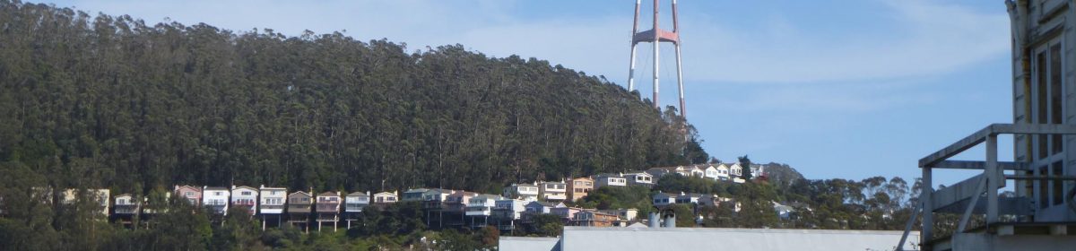
It’s been a foggy summer, and here in the Fog Belt, it’s been like living inside a cloud.

It’s the perfect time, if you like mysterious ethereal forests, for a walk in our neighborhood Cloud Forest. On a foggy day, it may be the most beautiful place in all of San Francisco .

So for those who haven’t done it before… here’s my personal guide to the forest.

There are several ways to approach the forest from our neighborhood, but I’ll divide them into the Adventurous and the Easy. On foggy days, you could describe them as Wet and Dry. Generally, there’ll be few people on either set of routes (though maybe a few more on the Easy ones).

If you double-click on the map above, you get a larger one that can be printed out. (There’s also a Sutro Forest trail map as a PDF file at Pease Press Cartography.)

THE ADVENTUROUS ROUTES

The two routes that lead directly from Forest Knolls are what I call adventurous, for two reasons.

First, access is very steep, especially for the first part of it. It involves scrambling up a trail. It’s not inaccessible by any means – I’ve been up there with neighbors in their sixties. But … it’s not a walk in the park. Also, it’s easier going up than coming down it, so you might plan a route that returns by a less steep path.

Second, on foggy days, it leads into the deepest Cloud Forest. This is actually my favorite part, but it’s Wet. The ground can get very slushy indeed, and I often return with much mud on my shoes and jeans.  Sometimes, the narrowest trails can become boggy.

The first route starts with a few steps opposite 365 Crestmont. On the map, it’s the West Ridge Trail. It’s narrow and you may need to go carefully, moving back blackberry stems as you go. (And be aware there may be poison oak around.)

The second is the access to the South Ridge, opposite 101 Christopher, between the lamp-post and the chain-link fence (fenced radar site) hidden among the bushes. It may even be a little steeper.

There’s also another access point on Crestmont, about halfway between these two, but I think that’s maybe unofficial. It seemed to have more poison oak, too. And finally, I have sometimes scrambled up the Gash left by the SFPUC’s water-pipe replacement (on Christopher) but I don’t recommend it because it’s very steep.  It brings you to the Aldea campus.

THE EASY ROUTES

The “dry” routes, which are still lovely but don’t feel as wild, start out in the Aldea Student Housing. If you want to drive up, you can sometimes find parking on Clarendon Avenue next to the campus. There’s no public parking on the campus itself.

Here again, there are two options.

1)  If you go uphill on Johnstone and then along  Behr, you will come to a chain blocking vehicle access. That’s the Nike Road, and it’s wide and paved. If you follow it to the top (this is a pretty short route) , you will find the Native Garden, officially the Rotary Meadow. It’s about 3 acres of shrubs, (which are green this time of the year) and grass (which is brown). It has  wide gravel paths, and is surrounded by the forest. You can investigate some paths with an easy out if it becomes too steep or slushy.

2)  The second option is the Fairy Gates trail, which starts on Johnstone, right in front of the Chancellor’s House. (That’s the very elegant house opposite the lower intersection of Johnstone and Behr. Do stop to notice the stand of redwoods right there…) This trail is pretty dry, not too steep, and quite broad except where it goes between two rocks (the “Fairy Gates”). It used to be more wooded in feeling, but some trees have been removed on either side and it’s now very open except at the beginning. It offers views of the forest in the ravine below, and has nasturtiums blooming along parts of it. It ends on the road through the forest, Medical Center Way. Though that is open to traffic, it has sidewalks. Also, not much traffic goes that way, especially not now when the bottom end is closed for construction. [ETA: It’s reopened. Watch out for cars, but there’s still not much traffic.]

If you feel like checking out the forest a bit more, the bottom part of the Historic Trail is also relatively dry, though if you follow it to the top it takes you back into the clouds. The Edgewood Trail will take you down  into the Edgewood neighborhood. It’s steep but not very muddy. This area has some huge trees and interesting terrain.

3. [ETA June 2011:  There is a new trail now from Stanyan (just above 17th) that climbs up to Medical Center Way. Of course, you can also take it in the opposite direction. Though it’s a climb, it’s quite broad and easy to hike. Its bottom end starts with a wooden staircase between two houses; the top end connects to Medical Center Way.]

OTHER TRAILS

These are many other trails, of course.  Exploring the whole mountain probably wouldn’t take more than 3-4 hours. The rule of thumb is that in areas where the forest canopy is open and the undergrowth thinned, the trails tend to be dry (and sometimes slippery with dust and dry leaves). Where it’s closed, and the undergrowth remains, it’s usually damp or wet (and sometimes slippery with mud). Dress warm on foggy days, and expect it to be quite cool even on warmer ones. I always wear long sleeves, jeans, socks and walking shoes I can get muddy. (It also helps in case of poison oak… haven’t been hit by it yet, in all the time I’ve wandered around in there.) There’s a checklist here.

Despite all these warnings, this is a pretty accessible forest. To me, it’s completely worth it to be among those tall trees, their tops in the gray mist while inside the forest it’s fresh and green in the dimness. Birds don’t sing much in the fog, but there’ll be the odd tweet or rustle. Sounds get muffled. Usually, there are few people around. It’s the wild part of the woods. If it’s twilight, you might hear or see the Great Horned Owls.  For those who enjoy a little walk on the wild side, one of the best features of Forest Knolls is the forest.

Sutro Forest Planned Actions

As many of you know, UCSF is planning some major changes in Sutro Forest, the dense eucalyptus forest behind our homes – the “Forest” in Forest Knolls. Many of these will affect our neighborhood directly. Details are on the SaveSutro website. A few people from our neighborhood – including Walter Caplan and Kristine Zaback from the Forest Knolls Neighborhood Organization – have been attending these meetings.

1) On South Ridge (the forest area above the junction of Christopher and Crestmont) UCSF plans to cut down around 2000 trees on 3 acres to space them an average 30 feet apart,  mow down all the plants growing under the trees, and use Roundup/ Garlon on a 1-acre test site to prevent it from coming back.

Our concerns are the use of herbicides upslope from our neighborhood, potential for displaced wildlife (including rodents) to move into our area, micro-climate changes and how it will look.  Drying out the forest by thinning the trees may also create a fire hazard similar to the forest in 1934, when it was being logged.

No other demonstration area lies directly above a residential neighborhood, and we had hoped UCSF would consider a different area. It hasn’t.

2) The trail leading straight up from Christopher into the forest will be re-routed into a hairpin trail that lies above Christopher. Houses below this route may lose some privacy as trail users will be able look down into them.

3) A new trail will be cut from Clarendon behind the new pump station and through the curtain of trees between the Aldea student housing and Christopher. This screen of trees has already been thinned considerably because of the PUC water project.

In the map above: 1 is the Gash cut into the forest for the water-line; 2 the concrete pad that was supposed to be returned to the forest but has instead been enclosed with a chain-link fence; 3 the area of the old pump station where the thinned trees make the buildings on the Aldea campus quite visible; and 4 the new pump station, with very few trees behind it. The blue lines are the planned new trails, and the pink one the existing trail. (Edited to Add: The aqua line shows the boundary of UCSF’s Aldea Student Housing.)

Residents nearby had hoped the screen would be regrown, not further thinned. In fact, there is no hope of a screen of trees between the new pump station and the Aldea campus; there’s no space. The pump station grounds extend nearly all the way to the Aldea campus boundary.

Pump Station on poster
New Pump Station in reality

The issue of hazardous trees along Crestmont was also raised. UCSF says they are the City’s responsibility; apparently the City, after staging the area (see the picture) has said they are UCSF’s problem and didn’t remove them. UCSF said they would discuss the matter with the city.

Edited to Add 1: Crestmont does not appear to be on the list of streets with City-maintained trees.

Edited to Add 2: We understand neighbors complained to the SF Fire Department. UCSF’s Barbara Bagot-Lopez sent out a message saying: San Francisco Fire Department had recently issued a “Notice of Corrective Action Required” stating that an area of the Reserve above Crestmont Avenue contains an “accumulation of combustible material”; UCSF will be resolving this issue.

We hope the corrective action will deal with the hazardous trees rather than merely further implementation of the predetermined plan.

Edited to Add 3:  Kathleen asked for contact information. Here it is:

Whom to contact:

For UCSF, there are whole bunch of people. The Chancellor, Dr. Susan Desmond-Hellman, is at 3333 California Street, Suite 103, San Francisco, CA 94143. Here’s a link to others involved.

For SF PUC: Not sure, try Suzanne Gautier(SGautier@sfwater.org). Here’s a link to the meetings schedule of the SFPUC Commission. (If anyone has other contacts/ resources, please note them here.)

For the City, the Urban Forester is at (415) 641-2674.

Mayor Gavin Newsom and Supervisor Sean Elsbernd are at City Hall, 1 Dr. Carlton B. Goodlett Place, San Francisco, CA 94102.

Mayor Newsom: Telephone: (415) 554-6141;  Fax: (415) 554-6160;  Email:  gavin.newsom@sfgov.org

Supervisor Elsbernd:
(415) 554-6516; Fax (415) 554-6546 – fax; Email:  Sean.Elsbernd@sfgov.org

Sutro Forest – by Pissarro?

The De Young Museum has a brilliant display of Impressionist artwork right now. (The museum’s website is here.)

While the Musee d’Orsay is closed for renovations, we’re getting to see a hundred of its masterpieces in two exhibitions. Yesterday, I was there with friends. They’re marvelous – amazing pictures, beautifully displayed, and arranged. Some of them are so well-known that they’ve become part of the idiom of popular culture. Whistler’s Mother. Manet’s Fife Player. Degas’s Dancing Lesson.

But what I especially noticed was a quiet Pissarro, called Path Through the Woods in Summer. It reminded me so much of our own Sutro Forest, it could almost have been painted there. Except for the horse, of course (or maybe it’s a mule).

Actually, when the Legion of Honor had its 2006 Monet exhibition, I noticed how the landscapes resembled the Bay Area – so much so I felt I could have replicated some scenes with photographs from around San Francisco.

This is the first time, though, that the resemblance has been so close to home.

Report on West of Twin Peaks Central Council Meeting

Following a heads-up from the neighbors working to preserve the Laguna Honda Reservoir, I attended a meeting of the West of Twin Peaks Central Council (WTPCC).  The WTPCC is a council of councils; its members are the neighborhood organizations from all over San Francisco’s west side. We met in the quaint Maybeck clubhouse in Forest Hill. Nestled under tall redwoods, the place has a charming, almost medieval atmosphere.

After thanking two members of the Council who were retiring (to the tune of “Jolly Good Fellow”!), the chairman George Wooding rapidly got through several agenda items. Some that are relevant to our neighborhood:

  • Regarding the gravel yard at Laguna Honda Reservoir, he had attended the June 6th meeting with the PUC.  He said the PUC had a moratorium in place until July 15th at least. The Home Owners’ Association of The Woods, a residential community adjacent to the reservoir,  is joining the WTPCC.
  • About Sutro Forest, he mentioned that UCSF was having a community meeting on June 30th.
  • The current owners of Park Merced discussed what was happening there. They are under financial pressure with loans coming due, but hope to negotiate with their lenders for a better payment terms. Meanwhile, they are planning to build new housing and slowly phase out the older buildings. They assured us that existing tenants under rent control would be given comparable-but-new homes at the rent-controlled rate.
  • The evening’s main issue was the misuse of the Gift Fund of Laguna Honda Hospital (LHH). Apparently, a gift fund  described as being specifically for the welfare and happiness of the residents/ patients/ inmates of the hospital, has been utilized for the benefit of the hospital staff. The fund, which had reached around $2 million, has been run down to about $700 thousand. Its oversight structures have been disbanded, so now money can be taken out more easily. Several sub-accounts have been set up under the Gift Fund to utilize the monies for the nurses, doctors, and administrators of the hospital while cutting back on excursions for the residents.

George described WTPCC’s futile efforts to get inputs or explanations from LHH representatives, from various oversight institutions, and from the district supervisor. WTPCC passed a resolution to recommend an independent audit of the funds, restoring any misspent monies, and reinstating oversight structures.

Edited to Add: Regarding Laguna Honda Hospital, the Dec 2010/ January edition of the Westside Observer (links to a PDF file of the paper) notes that the City Controller has returned $350, ooo  to the Patient Gift Fund.

Admiring America

Some of you may know I wasn’t born here, that I moved here as an adult. Of course I recognized America is a democracy, and I thought I knew what it meant. Elections. Party politics. Politicians’ promises. “The worst form of government except all those other forms that have been tried from time to time…” (Winston Churchill).

Somehow or the other, over the last year, I’ve been drawn into community issues. We have a few of them around our neighborhood: among others,  UCSF’s plans for Sutro Cloud Forest; PUC’s plans for a gravel yard beside the Laguna Honda reservoir; and a builder’s plan for an apartment block at the end of a long narrow cul-de-sac on Crestmont. What I saw was that community action actually worked.

It was then that I realized what democracy truly meant: You don’t have to be Somebody to have a voice. And the corollary: Just because you’re a big and powerful institution, you don’t get to make unilateral decisions.

If you were born here, you probably think this article is just silly. You already know that your voice counts, that if something really ticks you off, you get to try to change things. It’s the American way. But I’m hoping this makes you feel a bit prouder about what goes on here. Community activism isn’t a universal truth.

Sutro Forest Update: We’re below the Demo Site

As some of you may know, I’ve been attending the Sutro Forest Community meetings. After the withdrawal of the FEMA application, UCSF has decided to return to a plan originally drawn up in 2001, after conducting its own Environmental Review. This calls for “thinning” the trees and removing the understory on a small area as a demonstration.

They are now talking of potentially three demonstration sites, of which the largest – 2 acres – would be on the South Ridge (above Christopher and Crestmont). They are considering thinning the trees to an average of 30 feet apart, and removing all the shrubs and plants that grow under them. They may use herbicides to prevent regrowth. This is planned for Fall 2011.

We’re concerned about the risk to other trees (because it’s windy on top of South Ridge, and thinning the trees may expose others to the wind); to wildlife that uses the understory as habitat; and to the forest, which is likely to become drier in the exposed areas. We’re also concerned about herbicides coming off the steep hillside into our community.

Further details are at the Sutro Forest website, along with a great deal of information about the forest. I’ll post an update from time to time, since it seems that our community will be most directly impacted by the new plan.

[Edited to Add: The area has been expanded to 3 acres, the largest single “demonstration area.” There’s a follow-up post at Sutro Forest Planned Actions.]

Neighborhood Meeting – Police, Traffic, Sutro Forest, and Crestmont

The Forest Knolls Neighborhood Organization meeting earlier this evening featured a number of speakers:

Police Captain Teri Barrett of the Park Station (at Waller x Stanyan) talking about crime.

The main problem in our (aside from speeding) was auto burglaries with broken car windows. (Don’t leave anything valuable visible! Put it in the trunk.) She was also enthusiastic about Comstat, an information technology that provides real-time information about crime; and about a reorganization that put more resources out at the stations. She also said if you want to be on the email list for the police blotter, email her at teresa.barrett@sfgov.org

Jack Fleck

Jack Fleck of the Municipal Transport Agency talking about traffic.

He spoke of the issues with putting in Speed Humps: cost, and pain for people in the disability community who have spinal problems. They do traffic studies. If 85% of cars are going at least 5 miles over the speed limit, they’ll consider it. He also discussed traffic from Clarendon School drop-offs and pick-ups.

Supervisor Sean Elsbernd talking about the traffic mess expected at St Francis Circle this summer, and Laguna Honda Hospital’s planned June 2010 opening.

Sean Elsbernd

He also took questions on various topics, including solar panels on reservoirs. (Yes, we will have them if the pilot project works. No, the power won’t come to our homes, it’ll go to the City.) And some got to see a cell-phone pic of his cute baby…

There was a Sutro Cloud Forest presentation, covering topics discussed at the Save Sutro website.

UCSF had applied for a FEMA grant to cut down 90% of the trees under 3 feet in girth, and remove all the understory, from a quarter of the forest, for the purpose of Fire Hazard Mitigation. In fact, CalFire classifies this area only as Moderate fire hazard, its lowest rating. Moreover, this is a Cloud Forest: the eucalyptus catches moisture from the fog, it falls into the duff which holds it like a sponge, and the understory further insulates it from drying out. So year round, it’s damp in the forest. Our concerns were that the Plan would open out the forest, making it windier and dryer, and also artificially reclassify the area as having a Very High fire risk, with implications for insurance and disclosure on sale of homes. Other concerns: increased landslide risk, toxic herbicides, weakening of the remaining trees, and loss of habitat for birds and animals  in this Historic forest.  UCSF has withdrawn its FEMA application, and has called a meeting for 24 March 2010 to discuss its next steps. [Edited to Add: The meeting report is here.]

Walter Caplan of Forest Knolls Neighborhood Organization, who ran the meeting, read out an email from Craig Dawson of Mt Sutro Stewards , which regretted he couldn’t make it and was concerned there would be no counterbalance to the Save Sutro presentation. Unexpectedly, he made it after all. He described his autobiography, the beauty of the forest, the Historic Trail the Mt Sutro Stewards are working on now connecting Stanyan with the forest, and the work they’re doing building trails all over the city. There did not appear to be any conflict with the prior presentation.

Dr Sam Sobol talking about Crestmont Hills.

The project, which had seemed dead, is being revived. An Enviromental Review is now in progress. Look here for more information, or at the Crestmont Preservation website.

We ran out of time for questions. If you put any questions in the comments here, we’ll forward them to the right person.

Current Issues

This area is to discuss and report on issues the neighborhood is facing.

1. The Crestmont Development. A builder wanted to add an apartment block at the end of Crestmont, a narrow winding road just below Mt Sutro. Most neighbors opposed it on the grounds of safety (landslides, fire access), neighborhood character (no apartment blocks in Forest Knolls); and infrastructure issues. [Edited to Add 1: Apparently stopped for now.] [Feb 2010 Edited to Add 2: Have heard that it may have been restarted.]

2. The 36 Teresita route. In 2009, the City planned to curtail the service of the 36 Teresita, the only bus serving Forest Knolls, on the ground of inadequate ridership. Neighbors pointed out that it was not so much a matter of numbers as a matter of access; there were people without cars who relied on the bus. For the present, the service continues, but no one is sure if the plan may yet be implemented. [Edited to Add: It appears that the feedback has been accepted, and the route changes –  implemented from 5 Dec 09 – will not affect Forest Knolls. However, the frequency falls to 30 minutes (instead of 20 during weekday rush-hours); and the last bus leaves Forest Hill at 11 p.m.]

3. Sutro Cloud Forest. In May 2009, UCSF, which owns the land on Mt Sutro just above Forest Knolls, planned to cut down thousands of trees on a quarter of the forest, including an area just above the neighborhood ostensibly in the name of fire mitigation. Opponents believe this is a ruse for a native plant conversion of the forest, and the fire threat is an excuse to get FEMA funding for a landscaping plan. They consider it dangerous because of increased fire hazard from a more open and dryer forest; greater landslide risk; concern about toxic chemicals (Roundup and Garlon) being used; and worries about the area being artificially reclassified as a High Fire Risk with impacts on disclosure requirements and insurance rates. (At present, Cal Fire notes there are no areas of Very High Fire Hazard in San Francisco.)

[Edited to Add 1: SaveSutro kept a daily Fog Log for September/ October/ November. The longest period the forest was without fog or rain was 7 days. The forest remained green and damp throughout. ]

[Feb 2010, Edited to Add 2: UCSF has withdrawn its applications from FEMA. It is looking for a different way forward. Details on the SaveSutro website.]

4. Extended parking meter hours in San Francisco. Despite Oakland’s unfortunate experience with extended hours on its parking meters (a revenue measure), San Francisco’s MTA still has such a plan under consideration. This does not directly affect the neighborhood, which does not have meters; but it affects the residents who shop or work in surrounding areas like West Portal or Miraloma. [Edited to Add: There’s a good discussion of this in the November ’09 issue of the Westside Observer. The article (on page 2) is by George Wooding, president of the West of Twin Peaks Central Council.]

5. Another issue that affects Forest Knolls indirectly is SF PUC’s plan to build a gravel distribution center on Clarendon Avenue, on the eastern edge of the Laguna Honda Lake. This area was apparently presented as a temporary staging post, but now is being made permanent. Neighbors are protesting.