Redistricting, SF Overlook, and Coit Tower: West of Twin Peaks Central Council Meeting, Jan 2012

Another day, another visit to a lovely building. This time, it was the Forest Hill clubhouse to attend a meeting of the West of Twin Peaks Central Council (WTPCC). This is a group of some twenty neighborhood organizations, including Forest Knolls Neighborhood Organization, The Woods, and Mt Sutro Woods Home Owners Association.

Here’s my take on it  — and things you might want to act on.

SF RPD  PROPOSES A $185 mn BOND

San Francisco Rec and Parks  had a bond issue back in 2008 and want to come back for more. Though Dawn Kamalanathan made an excellent presentation, with pictures of kids and playgrounds, I got a sense of skepticism from the room.

The first set of questions related to the funding: If SFRPD borrows $185 mn from the public, it will have to pay interest and then pay it back… with taxpayer funds. Where, people wanted to know, are the repayments coming from?

The second issue was that SFRPD has spent money on extensive capital improvements, but it doesn’t have the operating budget to maintain them – or indeed, anything else. One example was JP Murphy Playground, where they renovated and improved the clubhouse, and then laid off the director and closed it down. Someone else quoted a park in her area, where improvements were made and all the gardeners laid off or retired and weren’t replaced.

A third set of concerns – where I also spoke – was about the Natural Areas Program and how funding it is leading to tree felling, habitat destruction and a growing use of Tier I and Tier II pesticides. Is this a good idea to fund?

Later, someone pessimistically told me that bond measures always pass because they’re paid for by home-owners but voted for by renters – and renters are the majority in San Francisco. I dunno.  I was a little puzzled at the tone of the whole thing. It was not exactly, We really need to do these specific things, and so we need the money. It was more like, We really want to raise some money, and so you tell us how you want us to spend it. Odd.

SAN FRANCISCO OVERLOOK

The steep hillside above the planned development

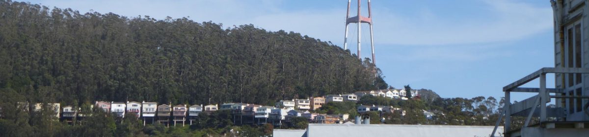
As readers of this site will know, the old Crestmont project slated for the dead end steep slope on Crestmont Drive has been revived in a new guise: San Francisco Overlook. (My article on the original project is here.) An Environmental Impact Report has been submitted to City Hall, and it’s under review.

The WTPCC wrote a letter in support of the Mount Sutro Woods Homeowners Association, which is spearheading the resistance to this dangerous project. (The picture here is the steep slope just above the planned development.)

COIT TOWER PRESERVATION GROUP

Jon Golinger made a presentation explaining that though the San Francisco Rec and Parks Dept (SFRPD) is making maybe $500 thousand a year from Coit Tower, it’s not maintaining the place at all. Lights are broken, signs are outdated and warped, and worst of all, there’s water damage on the historic murals. Meanwhile, SFRPD wants to change the concessionaire and rent out the space for private events.

The group is trying to get enough signatures to put a measure on the ballot to force SFRPD to spend some of the money it makes off Coit Tower in maintaining and improving it. If anyone would like to collect signatures for them before Feb 4th, please email me at fk94131@yahoo.com, I have a signature sheet. Their website is at ProtectCoitTower.org

REDISTRICTING SAN FRANCISCO

Every ten years, San Francisco’s districts are redrawn, based on population. This year, the growth in population in District 6, because of all the new building there, means all the lines have to be redrawn. Here’s the preliminary draft of the proposed new districts.

According the the tentative plan proposed by the Redistricting committee, Forest Knolls, Miraloma Park, Mount Sutro Woods, and Galewood Circle,  The Woods and Twin Peaks Improvement Association would all move to District 8.

The concern for WTPCC is that such an arrangement would mean that the concerns of the homeowners of the current District 7 would be over-ridden by the quite different concerns of the voters on the other side of Twin Peaks. They have made a different proposal. In the map below, everything within the blue boundary would be D7. (The colors denote the various Neighborhood Organizations.)

I think it’s a pretty good option, but I’m concerned that Mount Sutro goes into an entirely different district. Rising as it does above our neighborhood, everything that happens there (at least on this side) affects us. If the trees are felled and there are landslides when their roots die, our neighborhood is where they’ll land. If they start using pesticides as the Natural Areas Program does regularly on Twin Peaks, it’s our area it’ll wash into. If the tree-felling destroys the windbreak, guess which neighborhood gets the wind?

Meeting Report – Inner Sunset Park Neighbors – Summer 2011

I attended a meeting of the Inner Sunset Park Neighbors today. This group represents some 300 households in the Inner Sunset; the meeting was chaired by Andrea Jadwin.  Since this is just below our neighborhood, I’m reporting some updates:

PARKLET ON 9TH AVENUE

The parklet outside Arizmendi Bakery (on 9th Avenue) is probably going ahead. This will be a small area with chairs and tables for anyone to sit.

Opponents have chiefly been concerned about putting people so close to traffic; supporters love the idea of a place to enjoy the neighborhood (and perhaps a delicious snack from Arizmendi!)

INNER SUNSET STREET FAIR IN OCT 2011

This year’s Inner Sunset Street Fair is scheduled for October 16th. This would be the second annual Inner Sunset street fair. They’re looking for donations and volunteers. Their website is here, with information about getting booths, volunteering and donating.

TILING STEPS

The Hidden Garden Steps project is also seeking donations and volunteers. Neighbors want to refurbish an existing staircase with a colorful ceramic tile mosaic — something like the brilliant tiled steps below Turtle Hill. The delightful design starts with a worm and mushroom at the bottom, and rises into a blue sky with flowers and a dragonfly.

PLANS OF THE BICYCLE COALITION

San Francisco Bicycle Coalition‘s Neal Patel made a presentation about their current initiatives. Apparently, 7 out of 10 San Franciscans use bicycles at least occasionally. The Coalition’s focus is on getting people to use bikes more, both for recreation and transport. They’ve added 34 miles of bike trails in 2009, but now want to have bike lanes connecting the city, safe for people from 8 to 80 to use. New bike lanes get people out on their bicycles.  Their vision is of a safe biking trail, ideally with a physical barrier between the bike lane and car traffic, from the beach to the Bay.

The Coalition also offers urban cycling workshops covering rules and safety for kids, adults, and older adults who haven’t been on a bike in years… Questions focused on safety (including cyclists’ respect for pedestrians), specific bike routes, and bike-share systems.

I wanted the Coalition to use its outreach capability (it has 12,000 members) to warn people to wear reflective clothing in the fog. I can’t say how many times I’ve seen cyclists riding almost invisibly on Twin Peaks and areas surrounding our neighborhoods.

ADVOCATING FOR PEDESTRIANS

WalkSF’s Elizabeth Stampe talked about her organization, which focuses on making SF safer and more fun to walk. Since we’re all pedestrians to some degree, this is important for everyone. She pointed out the 800 people were hit by cars each year in SF — and thought this was possibly an understated number.

She mentioned measures to improve safety:

  • School zone speeds will be reduced to 15 mph for most schools in the city, which will make it safer for kids to walk to school;
  • They’re looking for better law enforcement (people don’t stop at Stop signs, for instance, or yield to pedestrians as they legally should do);
  • Looking for ways to redesign streets to slow traffic down and curb speeding.

One person described his efforts to get action on the dangerous intersection at 8th and Lawton, the site of several accidents. He wanted a Stop sign put in there. The SFMTA refused because (a) it’s a bus route, and this would slow the bus; (b) it increases carbon dioxide emissions; (c) enforcement of Stop signs is a problem, they’re widely ignored so why bother to add more?

The subsequent discussion focused on other ways to make a street less speedy; Stampe pointed out that the most dangerous roads are wide, straight and one-way because they encourage speed. Someone suggested more of the pedestrian-activated yellow flashing lights at crossings. The yellow signs in the road median saying State Law required stopping for pedestrians also helps.

Besides advocating for safety, WalkSF has volunteer-led walks all over the city. The next one is 12 miles, “Peak2Peak.” Also, they will host a Mayoral Candidates’ Forum on September 12th. (Details on their website.)

UCSF’s COMMUNITY ACTION GROUP

Craig Dawson spoke about UCSF’s Community Action Group (CAG), of which he is a founder member. They provide input to UCSF about issues concerning the community.  UCSF initiated this group in 1991, when Laurel Heights neighbors were in legal battle with UCSF. They approached, Dawson said, their critics to be in the Group. He and Dennis Antenore have been on it since then. It includes four ISPN members: Craig Dawson; Dennis Antenore; Susan Maerki; and Kevin Hart.

The CAG is expecting to increase its activity as UCSF is currently working on its new Long Range Development Plan (LRDP) expected to be adopted in Feb 2014. Dawson urged neighbors to get more involved as the new LRDP would bring many changes affecting the neighborhood.

One issue is UC Hall, one of the oldest UCSF buildings. It was slated for demolition so UCSF could get within their “space ceiling” — a total amount of space the University can use within the Parnassus campus. (The ceiling was adopted when neighbors became concerned at the University’s rampant growth, but UCSF has exceeded it for many years.) However, it’s a historic Beaux Arts building, and some oppose its destruction. UCSF is now considering other uses for it; one possibility is housing, which would not count toward the space ceiling. The cost of a seismic retrofit may be an issue. Look out for public hearings.

Neighbors wanted to know how to get involved. UCSF’s Damon Lew (who was present) has joined ISPN, and will be posting information. Also, UCSF offered to host an ISPN meeting to discuss UCSF-related issues.

SUTRO STEWARDS

Speaking as Executive Director of Sutro Stewards, Craig Dawson very briefly described activities on the “underutilized” 61 acres of Mount Sutro owned by UCSF: planting the Native Garden, building trails, and preserving native plants under the eucalyptus. There was no mention of UCSF’s proposed plans to cut down thousands of trees.

Update: Fight the SF Overlook Development, Get the T-shirt!

The steep hillside above the planned development

Readers of this blog will know that the much-opposed Crestmont Development (34 units at the end of a narrow road on a steep slope) is back with a new name, The San Francisco Overlook. It’s still 34 units, it’s still at the end of a narrow road, and the hill remains pretty steep. The Environmental Impact Report is in its final phase, and comments will soon be due.  The neighborhood coalition is geared up for the battle (pardon the pun) with t-shirts, sweatshirts and bags.

Here’s where I  first described the problems with this development — with some maps showing exactly why it’s a bad idea.

This update was sent by the Crestmont-Mt.Sutro-Forest Knolls Neighborhood Preservation Coalition. (It’s republished with permission and added emphasis):

SF OVERLOOK Development Threatens Our Neighborhood!

EIR in Final Phase!

Preparing for Upcoming Publication of 2nd Draft of EIRUpdate, 6-25-11

As summer has begun, we are awaiting the publication of the 2nd draft of the  Environmental Impact Report (EIR) pertaining to the SF Overlook 34-unit condominium project at the end of Crestmont Drive. Once it has been published, we will have 30 days to  express our concerns and objections regarding this oversized development which will add far too much traffic, parking congestion and density to our neighborhood.

We will notify all of our Mt.Sutro Woods and Forest Knolls neighbors when the time comes to deluge the Planning Department with letters. It will also be important that we  attend and speak at the public hearing which will be held by the Planning Commission.

With a united effort on the part of the community, we believe we can stop this project in its present form. If something must be built on this treacherous hillside, we are  fighting for a much scaled-back development of far fewer  single family homes which would address the critical issues  of safety, congestion and density at the end of this fragile cul-de-sac, and be more in character with the surrounding  neighborhood.

As a visible reflection of our resolve, we have adapted the  now familiar red and yellow “STOP SF OVERLOOK DEVELOPMENT”  poster to a line of t-shirts and sweatshirts. We have been  wearing them on our walks around the neighborhood and  several neighbors have expressed the wish to obtain these distinctive sportswear items for themselves and their family  members, to further spread the message of their objection to the proposed development.

If you are interested, the t-shirts and some other STOP SF  OVERLOOK items can be ordered here: http://www.zazzle.com/preservecrestmont. We will also post a link on http://crestmontpreservation.org.

We hope to see many neighbors at the hearing wearing these t-shirts and sweatshirts as they might send a powerful  message of neighborhood sentiment and cohesiveness!

REMINDER:
Please display the poster in your window and urge your neighbors to also display the poster!  If you need a poster, please call 415-640-3869 or email info@crestmontpreservation.org.


Copyright and Sutro Stewards

As some of you already know, I received a letter from a major law firm on behalf of Sutro Stewards whose  Executive Director  is Craig Dawson. (It was actually for San Francisco Parks Trust and Sutro Stewards.) It said two things: First, that I had defamed Craig Dawson and the Sutro Stewards; second, that I had violated copyright on two maps.  Most the of the allegations pertained to another website, www.sutroforest.com, which is a website fighting for Sutro Forest.

(Anyone who is interested can find my discussion of their allegations here.)

However, the copyright issue touches this website via a map I published in my post on hiking in the forest.  I believe the map I used was based on one that was non-copyright. Nevertheless, I have taken down the map. For now, I’ve provided a link to a trail map; later I’ll add back a map for readers of the post to reference. [ETA: I’d also used it to explain what UCSF plans to do with the forest. That’s also been removed for now and will be replaced later.]

WHAT WAS THE ISSUE, ANYWAY?

The Letter said I had violated a Sutro Steward copyright.

This was confusing on several levels.

1.  The map I used was distributed at a meeting called by Rec & Park. Rec & Park circulated it as Exhibit B of a memo for an agenda item before the Parks Commission, cropped exactly as described above. It carried no copyright information or attribution. [ETA: This memo can be obtained from Rec & Park under the Sunshine law. Anyone can get a copy.]

Did Rec & Park steal the map without the Sutro Stewards’ knowledge? No. The minutes show that both Craig Dawson and Ben Pease were at the hearing and were thus fully aware of how it was being used. In fact, Craig Dawson is mentioned in the memo under “People to Contact.” (Maybe one of them actually provided the map to Rec & Park?)

In my understanding, this has the effect of making it non-copyright: It is part of a memo prepared by a Rec & Park employee, whose (official) work cannot generally be copyright; and it wasn’t attributed to any other source. That’s why I felt free to use and make derivative maps as the Letter described.

2. How was it ever owned by Sutro Stewards? The copyright of even the original map is owned by Ben Pease and Pease Press. (That’s what the Letter says, I don’t know because the map I’ve been using has no copyright info.) While I believe Ben is a member of the Sutro Stewards, he is an independent entity.  Did Ben Pease assign his copyright to Sutro Stewards? If so, shouldn’t the Letter mention it? If not, why isn’t it Ben Pease writing to me through his lawyer (or directly), instead of the Sutro Stewards through their lawyer?

3. So why did I take down the map? Well, I enjoy a discussion of copyright issues, but honestly, this is trivial. If it makes them happy, I’m okay with removing it. The map made the post easier to understand, and so I’ll look to replace it; but it wasn’t crucial to its value. The idea of that post was to share how to visit the forest, and I think it still does that.

And — I’d like to put in a plug for Pease Press Cartography.  The Sutro Trail map (a PDF file) isn’t the only map he has on his site. If you’re a hiker, check out his trail map of the whole city. It’s the kind of amazing, a local business based on one person’s cartographic skills. Even the name is cool, and he has a really delightful logo… look out for it.

[I’d welcome comments here — just bear in mind they’re moderated and won’t show for a few hours or even a day. Or of course by e-mail at fk94131 at yahoo dot com.]

Mount Sutro Cloud Forest Hike

It’s been a foggy summer, and here in the Fog Belt, it’s been like living inside a cloud.

It’s the perfect time, if you like mysterious ethereal forests, for a walk in our neighborhood Cloud Forest. On a foggy day, it may be the most beautiful place in all of San Francisco .

So for those who haven’t done it before… here’s my personal guide to the forest.

There are several ways to approach the forest from our neighborhood, but I’ll divide them into the Adventurous and the Easy. On foggy days, you could describe them as Wet and Dry. Generally, there’ll be few people on either set of routes (though maybe a few more on the Easy ones).

If you double-click on the map above, you get a larger one that can be printed out. (There’s also a Sutro Forest trail map as a PDF file at Pease Press Cartography.)

THE ADVENTUROUS ROUTES

The two routes that lead directly from Forest Knolls are what I call adventurous, for two reasons.

First, access is very steep, especially for the first part of it. It involves scrambling up a trail. It’s not inaccessible by any means – I’ve been up there with neighbors in their sixties. But … it’s not a walk in the park. Also, it’s easier going up than coming down it, so you might plan a route that returns by a less steep path.

Second, on foggy days, it leads into the deepest Cloud Forest. This is actually my favorite part, but it’s Wet. The ground can get very slushy indeed, and I often return with much mud on my shoes and jeans.  Sometimes, the narrowest trails can become boggy.

The first route starts with a few steps opposite 365 Crestmont. On the map, it’s the West Ridge Trail. It’s narrow and you may need to go carefully, moving back blackberry stems as you go. (And be aware there may be poison oak around.)

The second is the access to the South Ridge, opposite 101 Christopher, between the lamp-post and the chain-link fence (fenced radar site) hidden among the bushes. It may even be a little steeper.

There’s also another access point on Crestmont, about halfway between these two, but I think that’s maybe unofficial. It seemed to have more poison oak, too. And finally, I have sometimes scrambled up the Gash left by the SFPUC’s water-pipe replacement (on Christopher) but I don’t recommend it because it’s very steep.  It brings you to the Aldea campus.

THE EASY ROUTES

The “dry” routes, which are still lovely but don’t feel as wild, start out in the Aldea Student Housing. If you want to drive up, you can sometimes find parking on Clarendon Avenue next to the campus. There’s no public parking on the campus itself.

Here again, there are two options.

1)  If you go uphill on Johnstone and then along  Behr, you will come to a chain blocking vehicle access. That’s the Nike Road, and it’s wide and paved. If you follow it to the top (this is a pretty short route) , you will find the Native Garden, officially the Rotary Meadow. It’s about 3 acres of shrubs, (which are green this time of the year) and grass (which is brown). It has  wide gravel paths, and is surrounded by the forest. You can investigate some paths with an easy out if it becomes too steep or slushy.

2)  The second option is the Fairy Gates trail, which starts on Johnstone, right in front of the Chancellor’s House. (That’s the very elegant house opposite the lower intersection of Johnstone and Behr. Do stop to notice the stand of redwoods right there…) This trail is pretty dry, not too steep, and quite broad except where it goes between two rocks (the “Fairy Gates”). It used to be more wooded in feeling, but some trees have been removed on either side and it’s now very open except at the beginning. It offers views of the forest in the ravine below, and has nasturtiums blooming along parts of it. It ends on the road through the forest, Medical Center Way. Though that is open to traffic, it has sidewalks. Also, not much traffic goes that way, especially not now when the bottom end is closed for construction. [ETA: It’s reopened. Watch out for cars, but there’s still not much traffic.]

If you feel like checking out the forest a bit more, the bottom part of the Historic Trail is also relatively dry, though if you follow it to the top it takes you back into the clouds. The Edgewood Trail will take you down  into the Edgewood neighborhood. It’s steep but not very muddy. This area has some huge trees and interesting terrain.

3. [ETA June 2011:  There is a new trail now from Stanyan (just above 17th) that climbs up to Medical Center Way. Of course, you can also take it in the opposite direction. Though it’s a climb, it’s quite broad and easy to hike. Its bottom end starts with a wooden staircase between two houses; the top end connects to Medical Center Way.]

OTHER TRAILS

These are many other trails, of course.  Exploring the whole mountain probably wouldn’t take more than 3-4 hours. The rule of thumb is that in areas where the forest canopy is open and the undergrowth thinned, the trails tend to be dry (and sometimes slippery with dust and dry leaves). Where it’s closed, and the undergrowth remains, it’s usually damp or wet (and sometimes slippery with mud). Dress warm on foggy days, and expect it to be quite cool even on warmer ones. I always wear long sleeves, jeans, socks and walking shoes I can get muddy. (It also helps in case of poison oak… haven’t been hit by it yet, in all the time I’ve wandered around in there.) There’s a checklist here.

Despite all these warnings, this is a pretty accessible forest. To me, it’s completely worth it to be among those tall trees, their tops in the gray mist while inside the forest it’s fresh and green in the dimness. Birds don’t sing much in the fog, but there’ll be the odd tweet or rustle. Sounds get muffled. Usually, there are few people around. It’s the wild part of the woods. If it’s twilight, you might hear or see the Great Horned Owls.  For those who enjoy a little walk on the wild side, one of the best features of Forest Knolls is the forest.

Sutro Forest Update

A number of neighbors attended the meeting called by UCSF for 24 March 2011, including Walter Caplan, President of Forest Knolls Neighborhood Association. (Walter took the opportunity to explain the Crestmont issue to a cluster of people around the map of the forest.)

A Romantic Entrance to the Forest

UCSF’s meeting was intended to inform the neighbors about the reasons for the withdrawal of the FEMA application; reaffirm their commitment to a safe, healthy, beautiful and usable forest; and lay out next steps.

Barbara French opened the meeting with why they withdrew the FEMA applications:

  • They were more aggressive than the adaptive management principle called for in the 2001 Plan for the forest;
  • FEMA indicated that the environmental review would take about 2 years, much longer than UCSF wanted.
  • Once an environmental review started, UCSF would need to maintain the status quo until completion.

Instead, UCSF itself will do a full environmental review, as required by the California Environmental Quality Act . They hope to use UCSF funds that had been set aside as matching funds for the “FEMA project.” This review (through its Campus Planning office) would cover all intended actions over the full 61-acre area of the forest to avoid “piece-mealing.” It would take about a year, and would be preceded by three community workshops.

With the conclusion of the environmental review, eucalyptus trees would be “thinned” on 2 acres as a demonstration. (The location and nature of the demonstration would be subject to community input.) As soon as that was done, work would proceed on the South Ridge and Edgewood cut zones. The whole plan would take into consideration the rainy season as well as the bird nesting season.

There’s more information about the meeting and the timeline at the SutroForest website.

Tree trimming above Christopher

UCSF recently sent out a notice that it would be trimming and removing hazardous trees in the forest along Nike Rd, which connects the Aldea campus and the Native Garden at the summit.

This road (shown in yellow dots and marked with the ellipse)  is just above Christopher (shown in pink dots), and runs parallel to it for some distance.

UCSF’s notice says: “The work will take place Tuesday January 19 through Friday January 22. Staging will start after 8 am, and noisy work will be limited to the hours of 9am to 5pm.”

There are more details on the Save Sutro website.

Current Issues

This area is to discuss and report on issues the neighborhood is facing.

1. The Crestmont Development. A builder wanted to add an apartment block at the end of Crestmont, a narrow winding road just below Mt Sutro. Most neighbors opposed it on the grounds of safety (landslides, fire access), neighborhood character (no apartment blocks in Forest Knolls); and infrastructure issues. [Edited to Add 1: Apparently stopped for now.] [Feb 2010 Edited to Add 2: Have heard that it may have been restarted.]

2. The 36 Teresita route. In 2009, the City planned to curtail the service of the 36 Teresita, the only bus serving Forest Knolls, on the ground of inadequate ridership. Neighbors pointed out that it was not so much a matter of numbers as a matter of access; there were people without cars who relied on the bus. For the present, the service continues, but no one is sure if the plan may yet be implemented. [Edited to Add: It appears that the feedback has been accepted, and the route changes –  implemented from 5 Dec 09 – will not affect Forest Knolls. However, the frequency falls to 30 minutes (instead of 20 during weekday rush-hours); and the last bus leaves Forest Hill at 11 p.m.]

3. Sutro Cloud Forest. In May 2009, UCSF, which owns the land on Mt Sutro just above Forest Knolls, planned to cut down thousands of trees on a quarter of the forest, including an area just above the neighborhood ostensibly in the name of fire mitigation. Opponents believe this is a ruse for a native plant conversion of the forest, and the fire threat is an excuse to get FEMA funding for a landscaping plan. They consider it dangerous because of increased fire hazard from a more open and dryer forest; greater landslide risk; concern about toxic chemicals (Roundup and Garlon) being used; and worries about the area being artificially reclassified as a High Fire Risk with impacts on disclosure requirements and insurance rates. (At present, Cal Fire notes there are no areas of Very High Fire Hazard in San Francisco.)

[Edited to Add 1: SaveSutro kept a daily Fog Log for September/ October/ November. The longest period the forest was without fog or rain was 7 days. The forest remained green and damp throughout. ]

[Feb 2010, Edited to Add 2: UCSF has withdrawn its applications from FEMA. It is looking for a different way forward. Details on the SaveSutro website.]

4. Extended parking meter hours in San Francisco. Despite Oakland’s unfortunate experience with extended hours on its parking meters (a revenue measure), San Francisco’s MTA still has such a plan under consideration. This does not directly affect the neighborhood, which does not have meters; but it affects the residents who shop or work in surrounding areas like West Portal or Miraloma. [Edited to Add: There’s a good discussion of this in the November ’09 issue of the Westside Observer. The article (on page 2) is by George Wooding, president of the West of Twin Peaks Central Council.]

5. Another issue that affects Forest Knolls indirectly is SF PUC’s plan to build a gravel distribution center on Clarendon Avenue, on the eastern edge of the Laguna Honda Lake. This area was apparently presented as a temporary staging post, but now is being made permanent. Neighbors are protesting.