Health Fair – UCSF at Mt Zion – 18 June 2011

UCSF’s sending around emails about a health fair they’re holding on Post Street at Divisadero.  It sounds like a neat idea, so I’m putting it in here in case anyone’s interested.

From the email  from Damon Lew:

To Our Community,
We invite you, your family, your friends, and your patients to join us at the Mount Zion Community Health Day on Saturday, June 18th.

You will have access to health screenings, educational materials and activities, along with local entertainment and food vendors. Our goal is to celebrate, educate and promote good health! There will be over twenty booths featuring various Medical Center clinics and services, including:
• the Bloodmobile
• Cancer Center
• Division of General Internal Medicine
• Headache Center
• Nutrition Counseling Clinic
• Osher Center for Integrative Medicine
• Radiology
• Sleep Disorders Center
• Tobacco Education Center
• Women’s Health
• and more.

Event Details
Mount Zion Community Health Day
Outdoor Street Fair
Saturday, June 18, 2011
11:00 am–4:00 pm
Post Street between Divisadero and Scott streets

Did You Know?
We are approaching the centennial of the Hellman Building at Mount Zion—the cornerstone of the twentieth century hospital. Mount Zion has played an important role in San Francisco’s rich history by serving the Western Addition neighborhood and the San Francisco community from the end of the nineteenth century through the twentieth and into the twenty-first century. It has been a part of the UCSF Medical Center since 1990.

Celebrating our Community
The leadership at the UCSF Medical Center at Mount Zion, led by Associate Dean Jeffrey Pearl, M.D., is hosting this Community Health Day. It is a way to celebrate our local community, and to extend our thanks and appreciation to the neighborhood for its support of the Mount Zion campus.

We invite everyone at UCSF and in the community to join us in making this event a success.  For more information, contact the Fishbon Library at Mount Zion, (415) 885-7378 or visit: http://mzhealthfair.ucsf.edu/mzhealthfair/mz_health_fair.pdf

Please feel free to forward this information on to your colleagues, clients, and community networks!

[ETA – Note: The link above goes to the poster we’ve shown at the top of this post.]

Medical Center Way closed 26 & 27 Nov 2010

UCSF has sent out a notice that the newly re-opened Medical Center Way (i.e. the pretty Sutro Forest short-cut from  Clarendon to Parnassus) will close for two days.  From 8 a.m. to 5 p.m. Friday and Saturday, 26th and 27th November, the road will be blocked to traffic to allow heavy machinery through. They plan to re-open the road that Sunday morning. (In the map below, the green line indicates Medical Center Way.)

UCSF is removing 11 trees from the Western end of the new Regenerative Medicine Building (the “Stem Cell Research Building”). That’s the blue circle in the map above. The trees have been declared hazardous.


[Edited to Add Follow-up]

The trees have been removed; the road is open. Here are the Before and After pictures:

UCSF Parnassus Updates

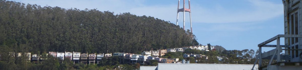
UCSF’s Parnassus campus lies just on the other side of the hill. We were not aware of the existence of the “Parnassus CAG Action Team” – a sub-committee of the UCSF Community Advisory Group (CAG) – until now. On Nov 8th evening, there was a meeting to update people on several matters.

The Agenda items that were directly of interest to Forest Knolls/ Sutro Forest:

1. Clarendon Connector Trail. There is still a plan to punch a trail to Clarendon through the screen of trees that lies between Christopher and the Aldea campus. (The blue line above Christopher Drive in the map below.) We protested that the screen had already been thinned by the actions of SFWD:  A Gash for the pipeline had been cut through the trees  to the water tank; and all the trees removed behind the new Pump Station. Putting a trail through this already tattered screen of trees would be counterproductive.

[ETA: The map here is being removed, but will be replaced later … see here for the reason why.]

The justifications used were confusing.

  • The first reason was to route trails away from the UCSF campus. But the alternative is for hikers to just walk along Christopher Drive for a few yards, it doesn’t go into the campus. Second, two trails already originate on the campus: The Fairy Gates trail starts right outside the Chancellor’s House; and the East Ridge trail opposite the new Community Center. There’s no plan to close off those.
  • The second justification is that it brings hikers closer to the highest point of Clarendon Avenue, where it’s safest to cross the street to the trails on the other side because hikers can see cars coming up the hill in both directions. (It’s marked “Safe” in red on the map. ETA: Correction – the “Safe” point is not the highest point, but the place where the road narrows to half its width). But it doesn’t do that either. It only brings hikers to the same place they’d get to from Christopher.

Craig Dawson (of Mount Sutro Stewards) said they would plant the sides of the trail to conceal it from the houses along the road. We are unsure about this; the “screen plantings” meant to screen the Aldea campus from Clarendon have not been very successful, and the chain link fence remains visible there. He also said the perception of thinning — apart from the area around the pump station, and the pipeline Gash — was because ivy had been removed from all the eucalyptus trees.

2. The Community Center (to be called The Aldea Center) on the campus is expected to be ready by this summer. It will be used by Aldea tenants, the University Community, the Mount Sutro Stewards, and to a lesser extent by Neighborhood groups. A few parking spaces will be associated with it; but the main access is expected to be by Shuttle bus or hiking in.

3. The Native Plant Nursery (now called the Aldea Seed Propagation area) is planned to go ahead; the idea is to grow plants for the Native Plant Garden at the summit, and maybe for other locations. This is the pad surrounded by chainlink on the Aldea campus. It was supposed to be “planted to blend in with the forest” as promised in an agreement with the community in January 2000 and reiterated in August 2009. UCSF’s Maric Munn said there are no plans at present to do that, but use as a nursery doesn’t prevent it in the future. Apparently UCSF’s  legal department has said that since no permanent structure is planned, it can be made part of the Open Space Reserve.

4. Bulletin Boards. Two bulletin boards, with maps and rules, are to be posted somewhere in the forest (not on the campus as originally discussed at the Agenda Planning meeting). One may be at the summit; another possibly on the historic trail.

5. Bike cage. A new bike cage is to be built on Parnassus Avenue outside Milberry Union, to provide bike commuters with safe storage. Three trees in the area will be preserved. UCSF has a $50K grant for this from SFMTA, and will match it with $50K of its own; vines will be grown over the front to improve its appearance.

6. The 68,500 square foot Regenerative Medicine Building (Stem Cell Research building) at the bottom of Medical Center Way is nearly ready; move-in could be in a week. It has a green roof, currently grass, but may be landscaped with other plants later. This building will have 250 people working there. UCSF has a 3.55 million square foot space ceiling for Parnassus; it was already 4% over this and planned to reduce that excess to 2%. Instead, it’s 6% over. This will have to be resolved in the new Long Range Development Plan, which will run to 2030.

———

Other neighbors’ concerns:

Traffic and congestion on Parnassus. Despite meetings and discussions and decisions, nothing had been implemented. Someone pointed out that unresolved issues remained from all the previous discussions and should not just be rolled over into the new Long Range Development Plan (to run to 2030).

Tree felling on Stanyan in connection with the Historic Trail opening. A number of trees have been cut down on the side of the forest behind Stanyan. Craig Dawson pointed out this was Rec and Park responsibility, and thought it might be in response to neighbors’ concerns about hazardous trees, expressed at meetings about the Historic Trail.

UCSF, plans, and the Long Range Development Plan. This is about to start now; the next meeting of the Community Advisory Group is on November 29th at 6.30 p.m. at Milberry Union.

Reopened: Medical Center Way

Medical Center Way is open again. This is the lovely mountain road that goes through Sutro Forest, connecting the UCSF Aldea student housing to Parnassus (and is the shortest route from Forest Knolls to Stanyan). I’ve heard it called the prettiest road in San Francisco, and people have told me they take that route just for its beauty. Certainly I’ve trundled down the half-mile stretch between Johnstone and the dog-leg above Parnassus  at 15-20 mph, taking in the splendour of the trees and the scent of eucalyptus. It’s looking shorn now; a lot of the understory growth has been cut back, and some of the trees are gone. But even if not the lush wild place it was before, it’s still lovely.

A spaceship in the forest?

It had been closed for nearly a year, for the construction of UCSF’s stem cell research building (or rather, The Center for Integrative Medicine). That building looked amazing in the drawings, and fantastic from Golden Gate Park: like a spaceship that had landed in the forest. And someone else, gazing at the building said, “It looks like it’s been CGI’d into the forest.” (If anyone has a better picture, please send it! This really doesn’t do it justice. ETA: Thanks… this is a lot better.)

Close up, not so much. Snaking along the lower reaches of Medical Center Way, behind the hospital on Parnassus, it’s sheathed in what looks like aluminum siding. “Like a trailer abandoned by the roadside,” sniffed my companion. It does have a rather boxy, automotive appearance, like an RV or a railroad car. This is a pity, because the actual structure has a lot of interest.


That’s visible from the loading dock side, which isn’t technically a public access area. The box curves along the road, and it’s balanced on a network of struts that isolate it from its base in case of an earthquake. With the tall trees behind and beside it, it looks somewhat surreal.

[ETA 2: Here’s another article on the building, with a lot of architectural details. I notice they’ve used our spaceship metaphor. The sincerest form of flattery! And this article is from UCSF itself.]

UCSF’s Temp Cellphone Antennae

In order to improve AT&T cellphone coverage in the shadow of Mt Sutro, UCSF is adding two temporary cellphone antennae: One at 400 Parnassus Avenue (which is down on their campus) and the other about halfway up Medical Center Way, quite near Edgewood Avenue. They’ll be on the roofs of existing buildings, and no trees will be felled on Medical Center Way to accomodate the antennae. It’s not overly visible (see the picture for a simulation, taken from UCSF’s Q&A pages). The temporary antennae will help AT&T coverage immediately.

A permanent installation is planned in about a year; that may be larger, and cover three providers. UCSF is looking at AT&T, T-Mobile, and Verizon.

Damon Lew, from UCSF’s Community Relations Office, sent out this message:

“To improve cellular phone service for doctors, nurses, patients, visitors, and staff of the UCSF Parnassus Campus, temporary cellular antennas will be installed on the Ambulatory Care Center at 400 Parnassus Ave. and on the Environmental Health & Safety facility at 50 Medical Center Way. Permanent equipment will eventually be installed to maintain good cellular telephone coverage and we will keep the community informed as the project proceeds. Installation of the temporary cellular antennas is scheduled to begin October 11…”

More information about this project can be found here:  http://community.ucsf.edu/pdf/Parnassus_Campus_Temporary_Microcellular_Sites_Questions_and_Answers.pdf .

If you have further questions about this project, please contact me at dlew@cgr.ucsf.edu or (415) 514-2651.

Christopher Crestmont Cleaned Up

A few days ago, I posted (here and here) about UCSF cleaning up the brush along Christopher and Crestmont. Over the last couple of days, I’ve been walking around and talking to people who live near there. It’s looking good.

They did a pretty neat job of trimming back the bushes that were overhanging the pavement, so it’s easier for cars to park without blocking the roadway. Some of the overhanging branches have been trimmed back too, and it’s all been nicely and professionally done so it actually looks good rather than raw and nasty. They’ve been careful to preserve plants that people had put in or nurtured along the road edge.

They actually felled and removed two hazardous trees along Crestmont. Any others presumably must await the full hazardous tree report.

And as a bonus, this old prickly-pear cactus appeared, apparently thriving under all the acacia! (You may need to click on the picture to embiggen it to actually see the cactus.)

Thanks, UCSF; and thanks, Forest Knolls Neighborhood Organization, which has been working to make this happen.

Separately, I’m not sure where the dispute with the city stands on who has responsibility for hazardous trees. The map below shows the issue: The purple line (I think) shows the UCSF boundary. (This map – made in Year 2000 -is based on an excerpt from the EDAW report done for UCSF. The colors just show in which direction bits of the mountain face…blue is north, red is west, yellow is south, and green is east.)

According to this map, the UCSF Open Space Reserve boundary is not exactly aligned to the roads. There’s a space between the road and the reserve. And that’s where some of the trees are that people are worried about. Of course, if the map is accurate, then one crucial area is fairly obviously UCSF’s: where Crestmont makes a sharp turn from North to East.

Crestmont Clean-up: Not the trees?

It’s a bit like the Prop 8 thing: Hurry up and wait.

It looks like I jumped the gun when I posted that UCSF was doing something about the hazardous trees. I’d written to UCSF to ask if they’d pulled permits to deal with the hazardous trees on Crestmont — from Devonshire to the cul-de-sac, and especially around the area where the road turns from west to north.  (City permits are needed to remove any tree over 20 feet tall if it’s within ten feet of a public right-of-way.)

Nope. That may be happening later. Here’s the response from UCSF’s Damon Lew:

The work that is beginning this week will focus on overgrowth and removal of hazardous ground material and not the removal of hazardous trees.

The trees you mention may have been identified in a recent hazardous tree survey that was done for the Facilities Management (FM) Dept.   The work that will be done once the tree hazard survey is received by UCSF will not take place until later this year.

So I guess right now it’s precisely what they said: Mowing down vegetation for 2 feet from the roadway, including overhanging shrubs. (This may take care of some overhanging trees, actually; we’ll find out.)

If you are living on Christopher or Crestmont and have plants across the road you want to save, it may be a good idea to mark them in some way. Or be out there to talk to the crew.

[ETA: Today Damon Lew sent out a notice that they actually will be removing two hazardous trees:

I’m writing to inform you that on either Monday, August 23rd, or Tuesday, August 24th, Bartlett Tree Experts will be performing the following hazardous tree work along Crestmont Drive:

· Cutting down 1 Monterey Pine located across from 171 Crestmont Dr.
· Cutting down 1 Monterey Pine located across from 90 Crestmont Dr.
· Time permitting – cut down branches overhanging the street within the area

The stumps of the trees will be cut down to 2-4” above grade and debris from the project will be removed from the site. These trees were recently identified as part of a hazardous tree survey performed by Hortscience and were also brought to our attention by several of our neighbors. No noisy work will be performed by 9:00 a.m. but staging of the area may begin earlier.]

Crestmont Christopher Clarendon Cleanup

Some time ago I wrote about the problems Crestmont residents in particular were having with hazardous trees on the edge of Sutro Forest, and in getting either the city or UCSF to do something about them. They eventually complained to the Fire Department. UCSF said they’d do something about it, and it looks like they will. [Edited to Add: Not quite…see followup post.]

It’s scheduled for August 18-27. There will be parking restrictions in some areas of Christopher and Crestmont while they work.

Here’s a letter we got from UCSF’s Damon Lew today:

Dear Neighbor:

I am writing to inform you that in response to both neighborhood concerns and a Notice of Corrective Action we have received from the San Francisco Fire Department, the UCSF Facilities Management Department has arranged to have grounds maintenance work done along Crestmont, Christopher, and Clarendon Drives. This work is scheduled to begin on August 18, 2010 and will be completed by August 27, 2010.  The nature of this work will include the following actions:

·         High weed mowing

·         Brushes and shrubs overhanging the street curbs will be trimmed back up to a distance of 24” from the curb

·         Dead and dying vegetation to be removed

This work is scheduled to take place between the hours of 9:00 a.m. and 5:00 p.m.  During this time parking along certain areas of Christopher and Crestmont Drives will be prohibited in order to allow access to the site.

Please feel free to contact me at dlew@cgr.ucsf.edu if you have any questions about this project or if you would like to be added to our listserv to receive updates about other projects pertaining to our Parnassus campus.

If you have questions or concerns during the operating hours of this project please contact the UCSF Customer Service Center at (415) 476-2021.

Sincerely,

Damon

Hope it goes well.

Just as a PS: Some neighbors have mentioned there are areas along Clarendon where our gardens, tamed or untamed, are spilling over the sidewalk and making it difficult to pass – especially in rainy weather. So this is a heads-up to anyone whose home backs onto Clarendon: Please check whether your plants are seeking world dominance by way of Clarendon Avenue, and if so, restrain them…